


 |
 |
 |
 |
 |
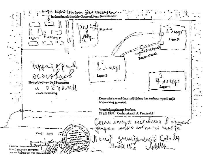 |
Alexander Petcherski Sketch
"Sacha" Petchersky, the Soviet officer selected from a Minsk transport in September 1943, was one of the main leaders in the plan for the Sobibor uprising. He worked felling trees in the new Camp IV (North Camp) and in the carpentry workshop in Camp I. |
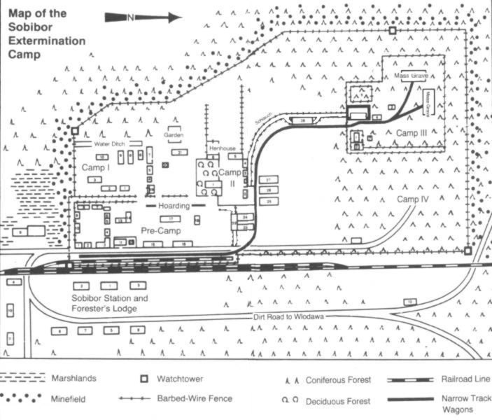 |
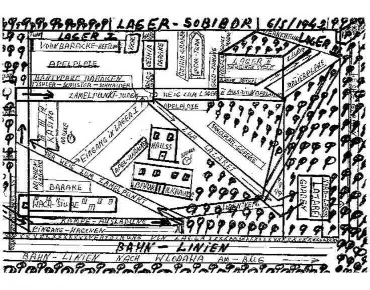
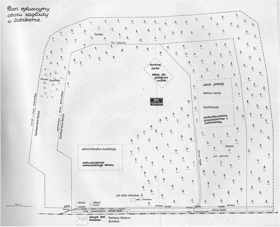
Hagen Trial Map
This map was used during the Sobibor trials in Hagen (6 September 1965 - 20 December 1966) and compiled by SS man Erich Bauer. It seems to be fairly accurate. |
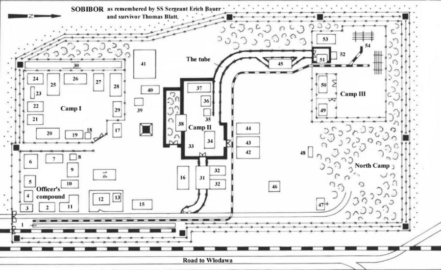 |
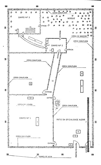
Bauer / Blatt Map
This map was compiled by survivor Thomas Blatt and former SS-man Erich Bauer ("Bademeister" at Sobibor). |
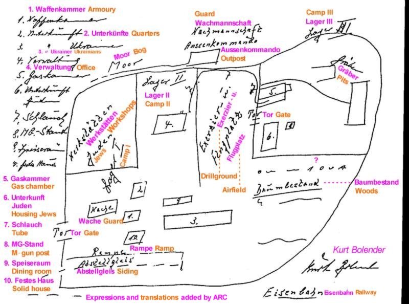 |
Kurt Bolender Sketch
This is just a sketch, but nevertheless must be taken into account as SS man Bolender worked in "Lager III" (extermination site). Therefore his depiction of this area may be fairly accurate. He also correctly placed the Wachmannschaft Außenkommando (Ukrainian "outposts") evident from the Sobibor 1944 aerial photograph. |
 |
Moshe Bachir Sketch
The survivor Moshe Bachir placed the direction of the tube perfectly. The "Lazarett" and his little drawings of the Ukrainian barracks with doors and window placements are of interest, as he obviously thought this of great importance to draw this in. |
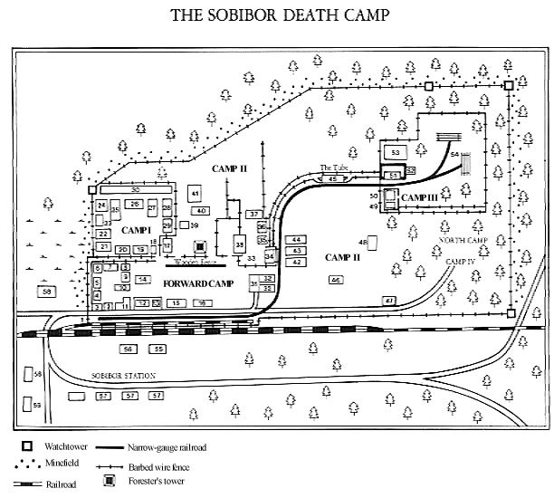 |
Yitzak Arad Map
Taken from "The Pictorial History of the Holocaust" p. 294. |
 |
Stanislaw Szmajzner Phase I Map
Stan "Schlomo" Szmajzner arrived at Sobibor on one of the first transports in spring 1942. His map is the only interpretation of the extermination camp in its early stage. Note the lack of barracks in Sobibor's primitive era. This map is taken from the book "Inferno Em Sobibor". |
 |
Stanislaw Szmajzner Phase II Map
Stanislaw Szmajzner's version of Sobibor in the second phase, when the death camp had been "refined". Note the additional structures on the map including the re-built gas chambers. |
 |
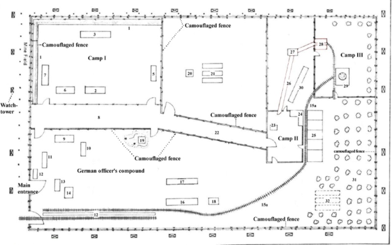
Schelvis Map
This map was drawn by survivor Jules Schelvis. |
 |
Schelvis Map with Monuments
This map was drawn by survivor Jules Schelvis. |
 |
Chaim Engel Sketch
Survivor Chaim Engel shows the route taken by the "work Jews" from Camp I to the sorting sheds in Camp II. To get there the prisoners had to bypass the narrow gauge railway tracks and the infamous "Tube" (Schlauch), the enclosed camouflaged path to the gas chambers. |
 |
GKBZN Map
Map of the Main Comission for Investigation of Hitlerite Crimes in Poland (GKBZNwP bulletin III, 1947). |
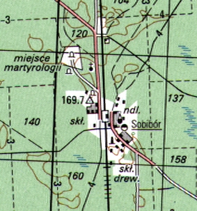 |
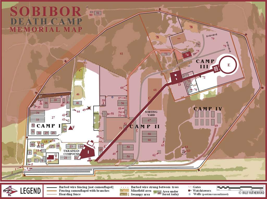
The Topographical Map
Official Polish topographical map of the deathcamp site as it appears today. The monument is indicated as well as the area where some of the mass graves were located. Naturally contouring of the area is also shown. |
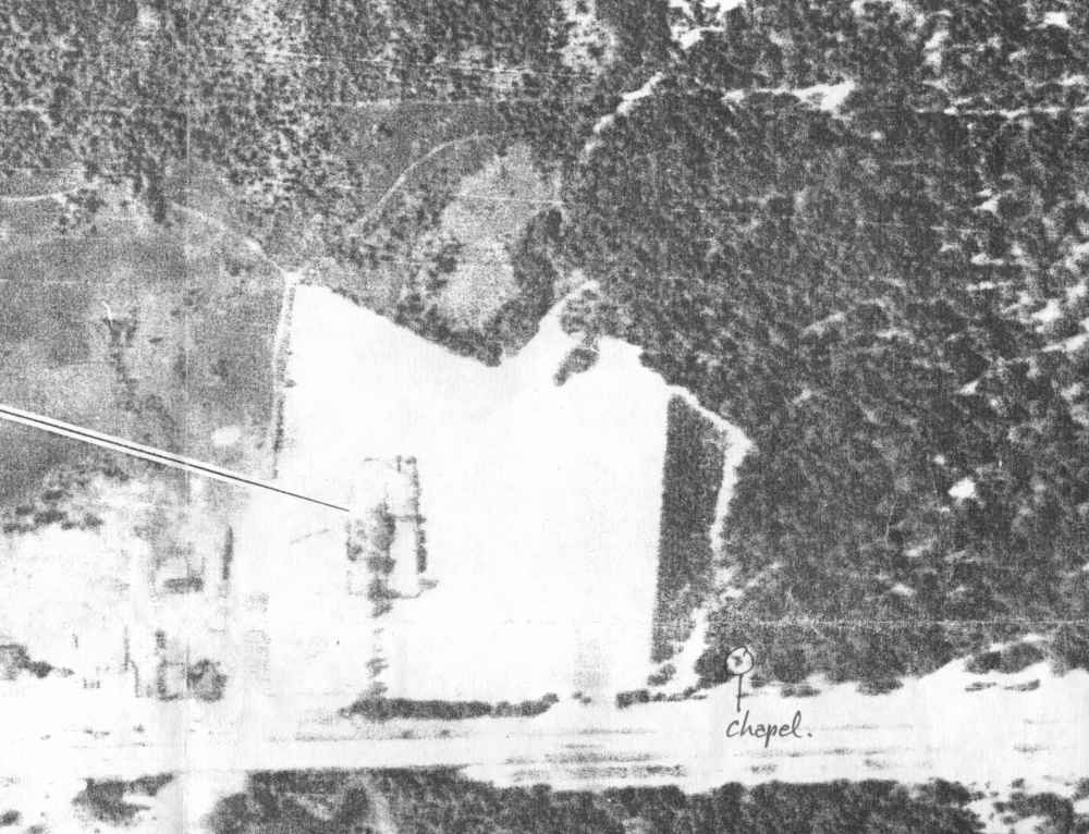 |
1940 Aerial Photo
This aerial of the future Sobibor death camp site was taken by the Luftwaffe in 1940. The extermination area has yet to be felled as is evident from the photograph. |
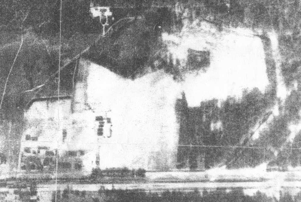 |
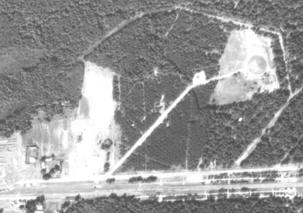
1944 Aerial Photo
Aerial photo of the remains of the Sobibor camp taken in 1944. Scarring of certain features are impossible to eradicate and can still be discerned. From this a calculated reconstruction for the New Sobibor Map is attempted but in certain areas the position of features and fencing still remains unsolved. Source: Aerial Photos from the National Archives, Washington DC. |
 |
1944 Drawing
This impressive drawing is based on a 1944 aerial photo, taken by the German Luftwaffe. The artist Arie A. Galles created this drawing. It is part of his work of art suite "Fourteen Stations/Hey Yud Dalet", exhibited at the Morris Museum in Morristown, New Jersey. See the artist's website: http://fermi.phys.ualberta.ca/~amk/galles/index.html |
 |
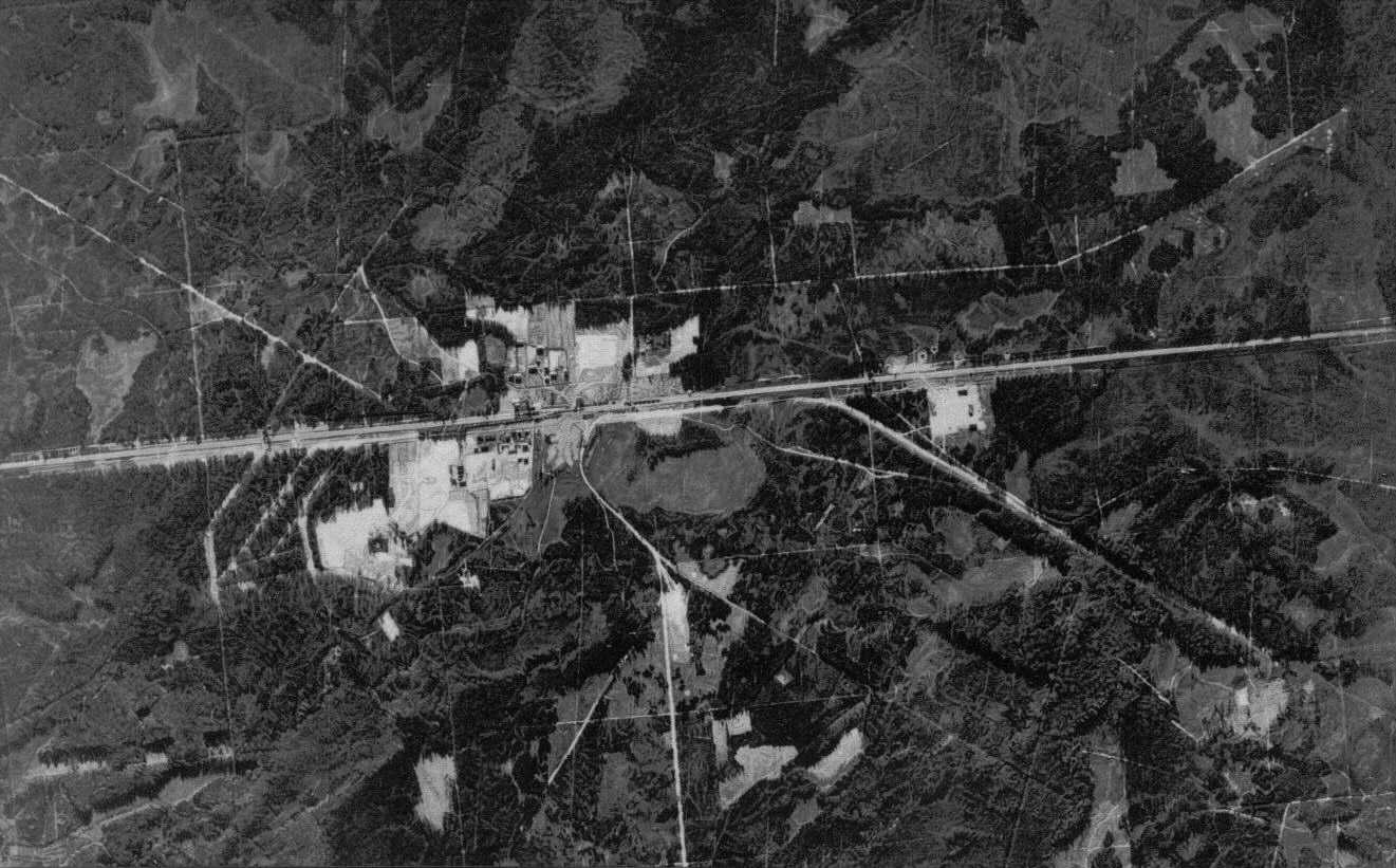
1971 Aerial Photo
The Sobibor 1971 photograph shows the "planted" forest to cover up traces of the former extermination site and has changed very little to the present day. |
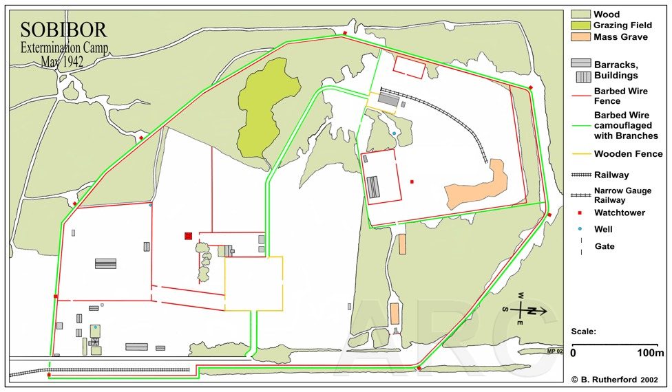 |
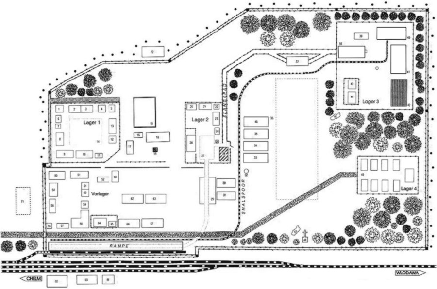
Newest Sobibor Map May
1942
Copyright: W. Rutherford. |
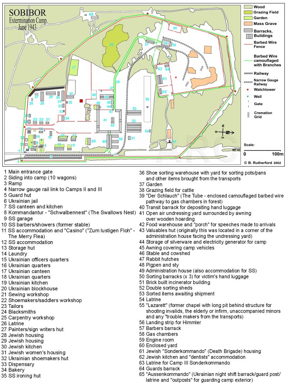 |
Newest Sobibor Map June
1943
Copyright: W. Rutherford. |
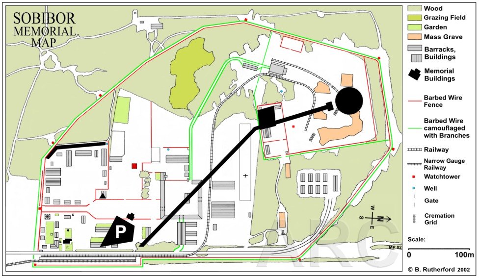 |
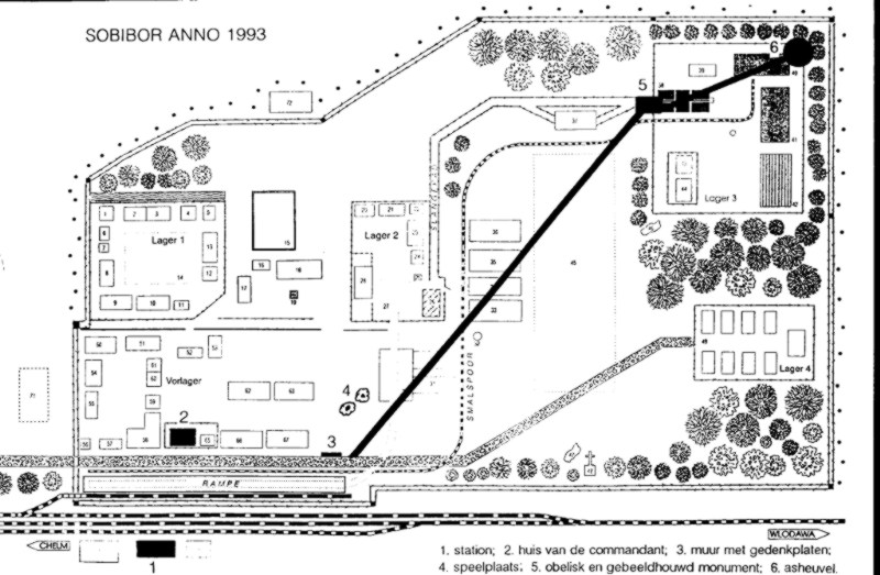
Newest Sobibor Map With
Memorial
Copyright: W. Rutherford. |