During my career I have made various models which had interactivity build into them. I like to introduce you to the most intricate interactive model I have made.
THE LADYSMITH SIEGE MAP
(LADYSMITH / SOUTH AFRICA)
(LADYSMITH / SOUTH AFRICA)
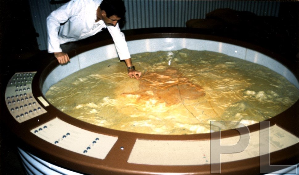
During the Anglo Boer War (1899-1902) the town of Ladysmith was laid to siege. A series of battles ensued around the town and various defence lines were set up. These events were depicted in an exhibition at Ladysmith Siege Museum of which this model formed the centre-piece.
I had to acquaint myself thoroughly with the actual terrain, collating research which was then interpreted to produce this interactive three dimensional topographical model.
The model had to show all the occupied areas during the Ladysmith Siege, with routes taken by invading forces, places of interest and hills etc. which was done by interactivity.
On the side of the model are consoles with information and 59 pushbuttons which, when activated highlighted sections by means of translucent lit areas as well as route indicators with about 200 Light Emitting Diodes (LED) in sequence (Note: The electronics under the console were sourced out.)
 |
| Interactive Model |
CONCEPT: Three dimensional topographical interactive map for display.
CLIENT: Ladysmith Siege Museum. (KwaZulu Natal)
MEDIA: First Styrene contours were cut, from this a negative was cast in plaster of Paris from which the final translucent fibreglass resin positive was obtained.
SIZE: 180 cm in diameter
SCALE: 1:50 000
RESEARCHED AND CREATED: 1984
© Peter Laponder 2006