
* Note to our viewers *
|
Unauthorized links to our website from the controversial and grossly inaccurate hate blog postings of the following persons: Roberto Muehlenkamp - Sergey Romanov - Dr. Nick Terry Are not condoned by ARC. We maintain no connection to Holocaust hate blogs, and would caution all to avoid being misled by these individuals. |


 |
 |
 |
 |
 |
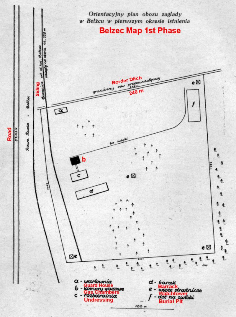 |
Belzec 1st Phase
This map was published 1947 in an article by Eugeniusz Szrojt: Oboz zaglady w Belzcu. Biuletyn Glownej Komisji Badania Zbrodni Niemieckich, Vol. III (1947). |
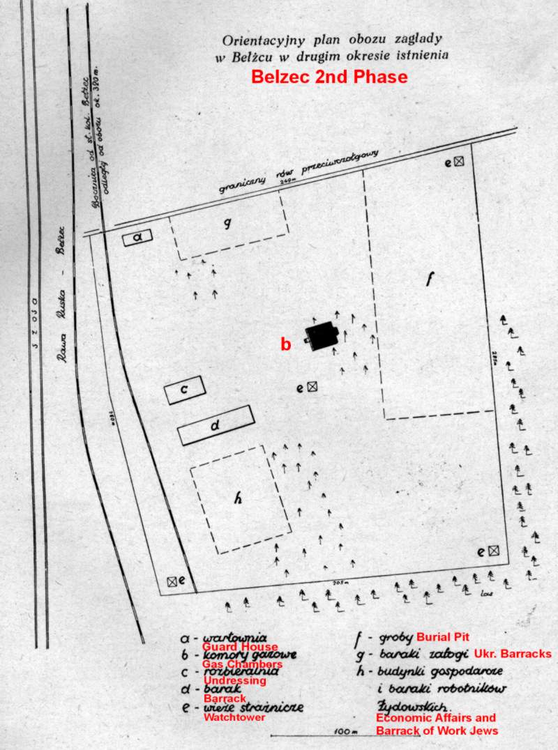 |
Belzec 2nd Phase
This map was published 1947 in an article by Eugeniusz Szrojt: Oboz zaglady w Belzcu. Biuletyn Glownej Komisji Badania Zbrodni Niemieckich, Vol. III (1947). |
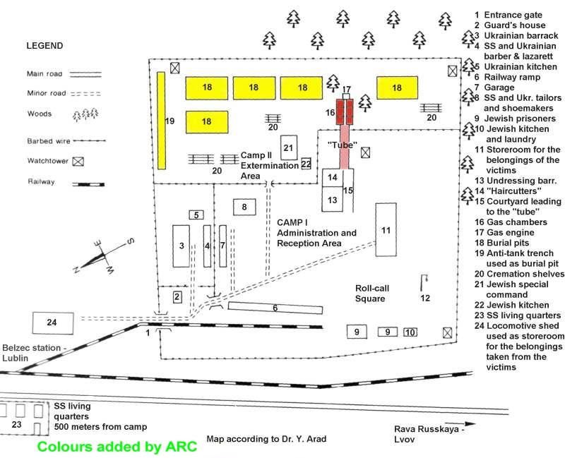 |
Arad Map
Map adapted from the book "Belzec, Sobibor, Treblinka - The Operation Reinhard Death Camps" by Yitzhak Arad. |
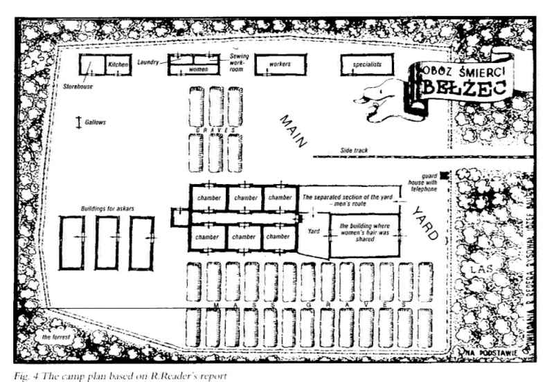 |
Reder Map
Map drawn by order of the survivor Rudolf Reder. |
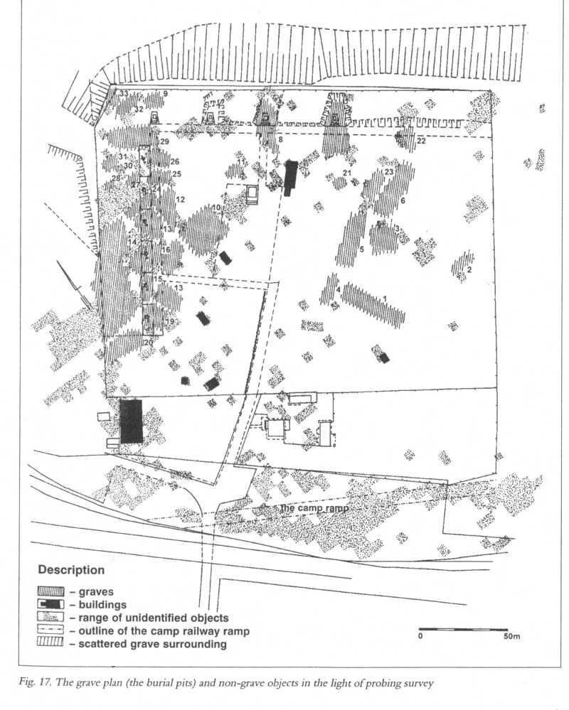 |
Kola Map
Map drawn by Professor Andrzej Kola, leader of a team of archaeologists from University of Torun. The excavations took place from autumn 1997 until autumn 1999. |
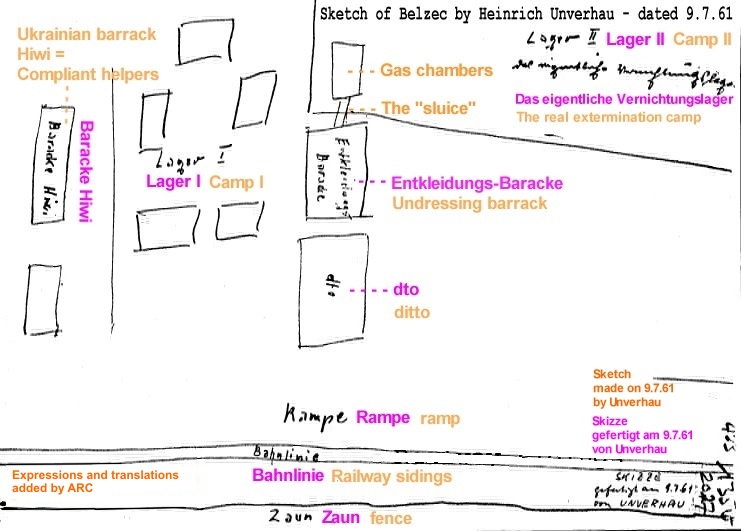 |
Unverhau Sketch
Sketch made by SS man Heinrich Unverhau in 1961. |
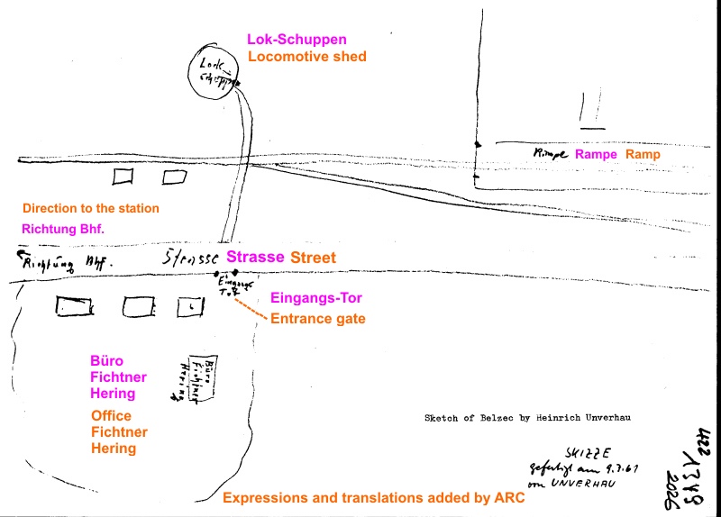 |
Belzec garrison - Unverhau Sketch
Sketch made by SS man Heinrich Unverhau in 1961. |
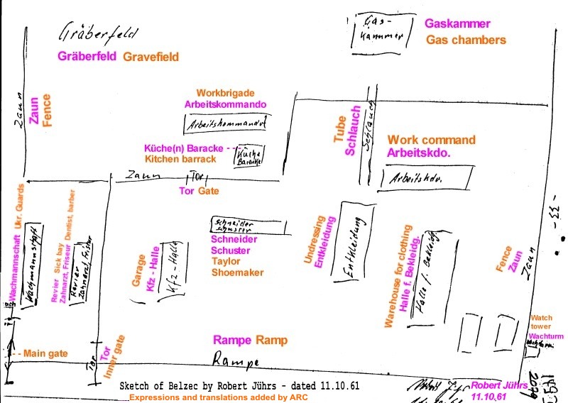 |
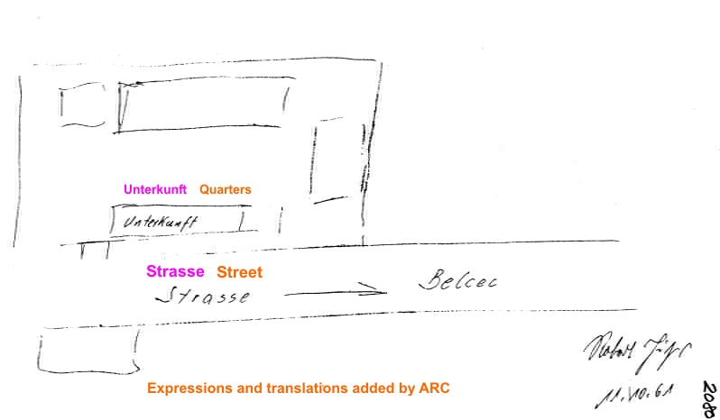
Jührs Sketch
Sketch made by SS man Robert Jührs in 1961. |
 |
Belzec garrison - Jührs Sketch
Sketch made by SS man Robert Jührs in 1961. |
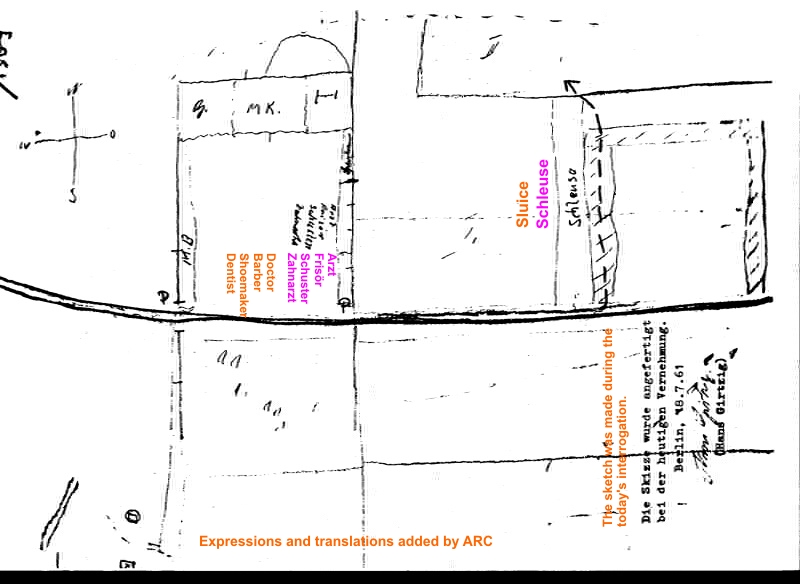 |
Girtzig Sketch
Sketch made by SS man Hans Girtzig in 1961. |
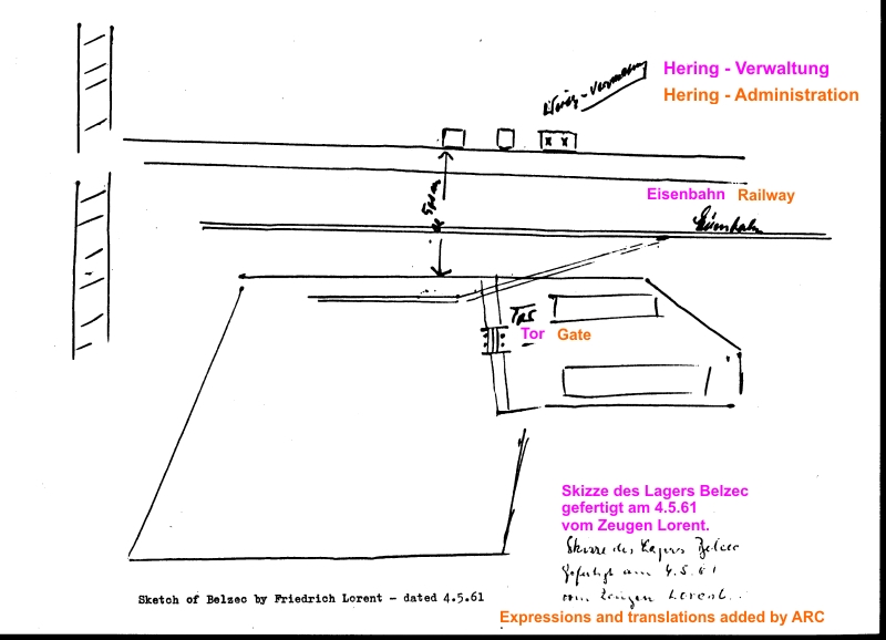 |
Lorent Sketch
Sketch made by Friedrich Lorent in 1961. |
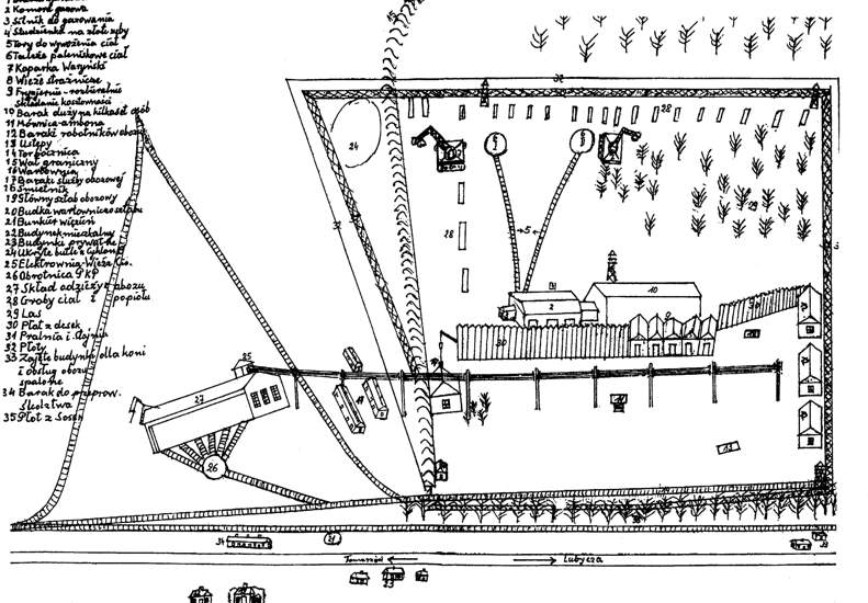 |
Krupa / Ragan Sketch
Belzec sketch by Jan Krupa and Bronislaw Ragan, drawn at the request of the Belzec village Mayor - circa 1971. |
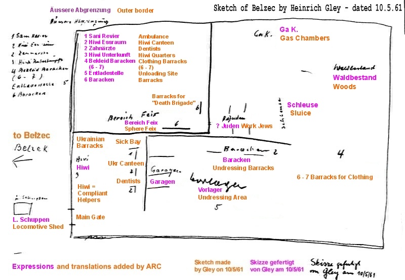 |
Gley Sketch
Sketch made by SS man Heinrich Gley in 1961. |
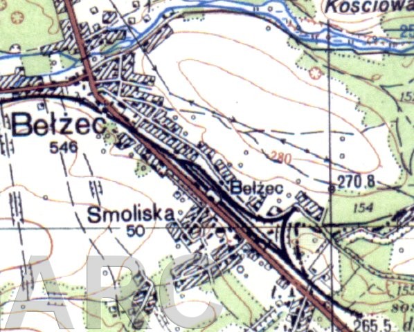 |
The Topographical Map
Official Polish topographical map of the deathcamp site as it appears today. |
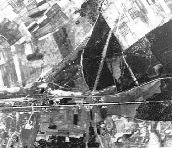 |
1940 Aerial Photo
This aerial photograph was taken in 1940 when the Belzec labour camp was being established. It shows the logging path cutting through the future death camp site toward the start of the railway spur which was eventually utilized for transports. The forest area (top right) has been cleared of trees. |
 |
1940 Drawing
This impressive drawing is based on a 1940 aerial photo, taken by the German Luftwaffe. The artist Arie A. Galles created this drawing. It is part of his work of art suite "Fourteen Stations/Hey Yud Dalet", exhibited at the Morris Museum in Morristown, New Jersey. See the artist's website: http://fermi.phys.ualberta.ca/~amk/galles/index.html |
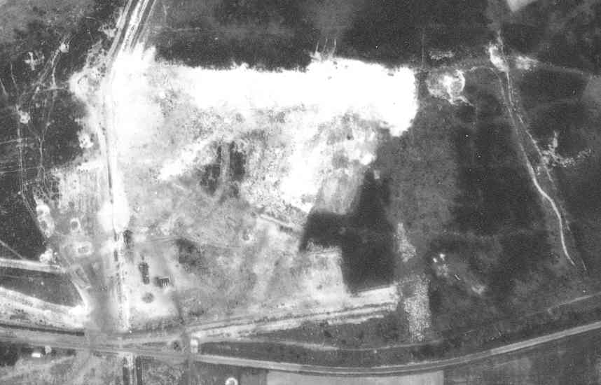 |
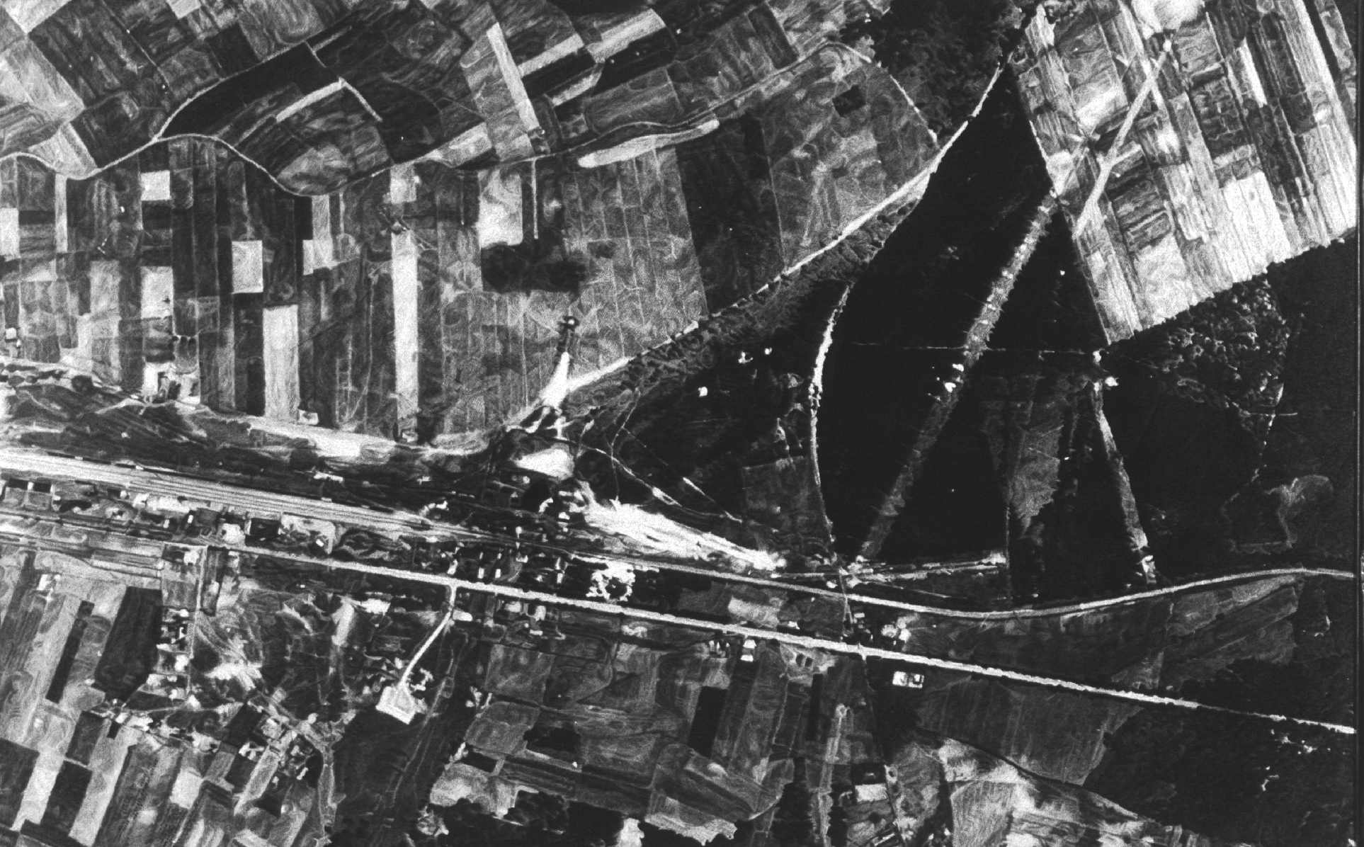
1944 Aerial Photo
This aerial photograph was taken in 1944 and shows the former death camp ground scarring from mass graves and structures. The two ramps are also evident from the photograph. |
 |
1944 Drawing
This impressive drawing is based on a 1944 aerial photo, taken by the German Luftwaffe. The artist Arie A. Galles created this drawing. It is part of his work of art suite "Fourteen Stations/Hey Yud Dalet", exhibited at the Morris Museum in Morristown, New Jersey. See the artist's website: http://fermi.phys.ualberta.ca/~amk/galles/index.html |
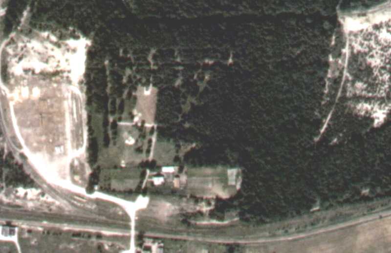 |
1998 Aerial Photo
This aerial photograph was taken in 1998 and shows the recently demolished 1960's memorials at the site of the former death camp. A new Belzec memorial is planned for the site. Part of the large area to the left was formerly the Ukrainian guard compound, the dense forest to the right was incorporated into the camp but mainly unused, refer to maps. |
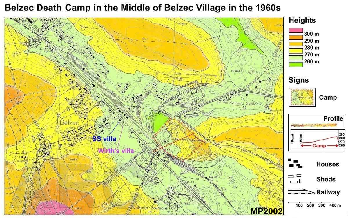 |
Belzec Camp in the middle of the village in the 1960s
This map shows the hights in colour. The higher the more reddish. It's clearly to be seen that the camp is located at a slope. The red line going through the camp site is the profile line which is explained in the legend. Obviously the extermination took place in the neighbourhood of many houses. Nevertheless Belzec is the most forgotten extermination camp of the Holocaust. Copyright: ARC |
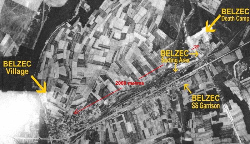 |
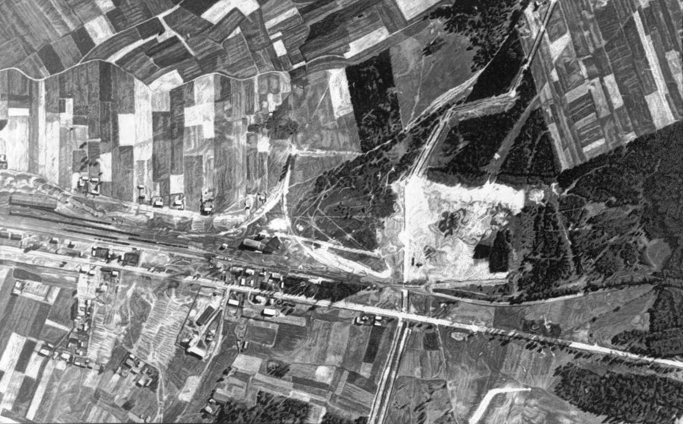
Belzec Camp in sight of Belzec Village
This air photo (taken in 1944) shows the location of the death camp in sight of the village. Witnesses still living in Belzec village testify that they suffered from smoke and stench produced by the pyres. |
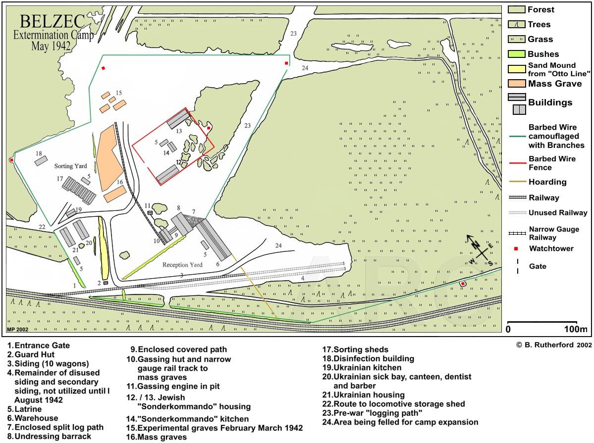 |
Belzec Camp May 1942
This map is based on the newest investigations of ARC in 2002. Copyright: W. Rutherford. |
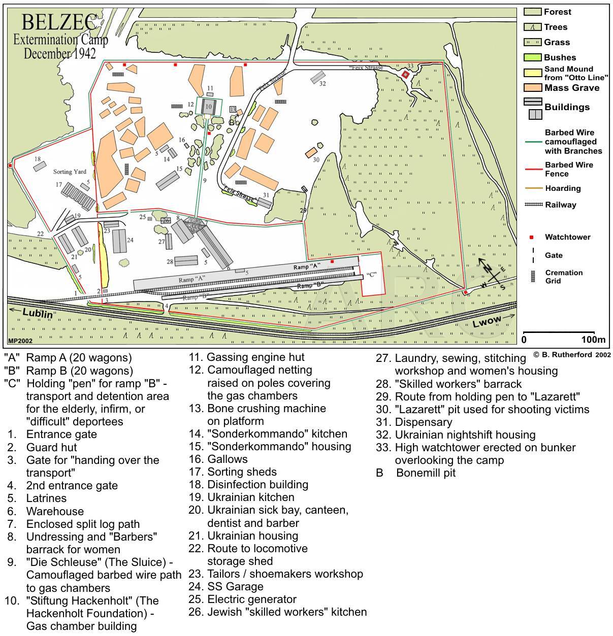 |
Belzec Camp December 1942
This map is based on investigations of ARC in 2002. The cremation grids were erected at different stages from November 1942 until April / May 1943. This is only a representation of all pyres and graves found at the archaeological dig. Copyright: W. Rutherford. |